Año: 2019
Locación: Pachacamac, Lima-PE
Tipología: Patrimonio & Paisaje
Área: 460, 000m2
Estado: Concurso-Diseño Preliminar
*En colaboración con ANDES & Vincent Juillerat
To be understood and intervened, heritage must be approached in a multidimensional way regarding its cultural, landscape, infrastructural, mythological, urban, and social aspects. Operations on Heritage reveal cultural practices and can transform their representation and meaning. Facing the immense challenges of an intervention in a context as complex as Pachacamac requires in the first place to ask the right questions. After a thorough analysis of the place, our team defined 3 key questions that serve as general guidelines to develop our project strategies.
1. How to reconcile, through the project, the territorial understanding of the prehispanic civilizations and modern society?
The archaeological site of Pachacamac and its surroundings are currently a constructed landscape that reveals a clear rupture between the Andean cosmovision of pre-Hispanic civilizations and the anthropocentrism of the modern world. Each one with his way of occupying and understanding the territory. Without prejudice to the value of one or the other, the design of the project must be able to reveal these two conditions and make them coexist in a less conflictive way. In the Sanctuary of Pachacamac, landscape architecture can participate in an update of the heritage, in terms of uses and meanings, far beyond a simple value enhancement. In short, articulate the past, the present and the future. Pachacamac represents in the end an incredible patrimonial deposit because it condenses, besides the material vestiges visible in the monumental zone, a story yet to be revealed.
2. How to embrace and resist urban conditions?
The northern sector of the Sanctuary, inserted in the city, has at the moment the potential to become a large-scale public space, but at the same time an attractive void for future informal invasions. This enormous void defines an hermetic border with the adjoining urban fabric that transforms this sector into a kind of "non-place" inhospitable to the surrounding populations. Our team became aware that many urban conditions (expansion, heritage, flows, uses, climate, material, topography, tissue, etc.) of the place contain potentials and risks and then demand sometimes contradictory answers to redefine the edge of the Sanctuary. But beyond the edge theme, and in addition to trying to solve the formal "seam" of these two worlds (pampas of sand and urban fabric), the strategies of our project identify and integrate the complexity and duality of urban conditions to inscribe the project in a permanent and subtle dialectic between "embracing" and "resisting" in a multi-scaled and multidimensional way.
3. How to articulate the relict and ecological conditions of landscape?
It is impossible to understand the magnitude and the exceptionality of Pachacamac without addressing it as an essential component of an unprecedented pre-Hispanic territorial planning. At present, the ruins of the Southern Sector are enclosed in a "small" area of 158 hectares, an isolated fragment, and only allow a partial understanding of the cultural landscape of Pachacamac that included several ecological levels at the infrastructural and mythological level. So, Pachacamac is an archaeological site with a lot of history, but with a memory partially hidden. The sustainable domestication of the landscape at different scales of the pre-Hispanic civilizations represents one of the most fundamental patrimonial values. A key of the project is to find design strategies that manage the articulation between the relict condition of the landscape with its ecological function. This articulation allows transforming the site of Pachacamac from ruins to project.
PROJECT STRATEGIES
The archaeological site of Pachacamac and its surroundings are currently a constructed landscape that reveals a clear rupture between the Andean cosmovision of pre-Hispanic civilizations and the anthropocentrism of the modern world. Each one with his way of occupying and understanding the territory. Without prejudice to the value of one or the other, the design of the project must be able to reveal these two conditions and make them coexist in a less conflictive way. In the Sanctuary of Pachacamac, landscape architecture can participate in an update of the heritage, in terms of uses and meanings, far beyond a simple value enhancement. In short, articulate the past, the present and the future. Pachacamac represents an incredible patrimonial deposit because it condenses, besides the material vestiges visible in the monumental zone, a story yet to be revealed.
HERITAGE it is developed at 3 different scales and allows to relate the value of memory of preHispanic heritage and a new value of use:
I-INTEGRAL ROUTE
The project proposes a pedestrian circuit with a cycle path that crosses the Lurín valley, connecting the natural and patrimonial elements to offer the inhabitants of Lima a path to relax. In addition to its functional dimension, this comprehensive tour regains the territorial scale of the Sanctuary, settling on an exceptional cultural landscape that connected many natural sites and ecosystems of the Lurín Valley (sea, islands, hills, valleys, the River, Plateau of Lurín, wetlands , Qhapac Ñan roads, etc.). Another objective of the integral circuit is to put the value of the ecological importance of its basin, and its fragility, remaining as the last valley of the 3 valleys of Lima that has not been cemented completely.
II-SECTORS
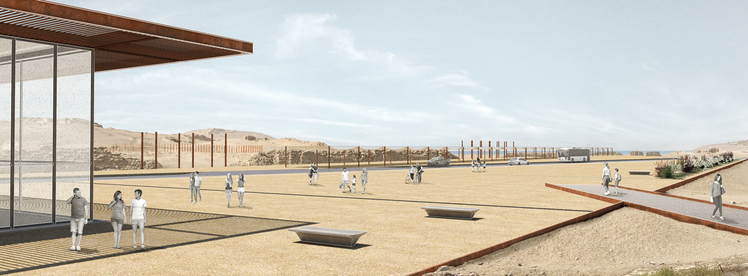
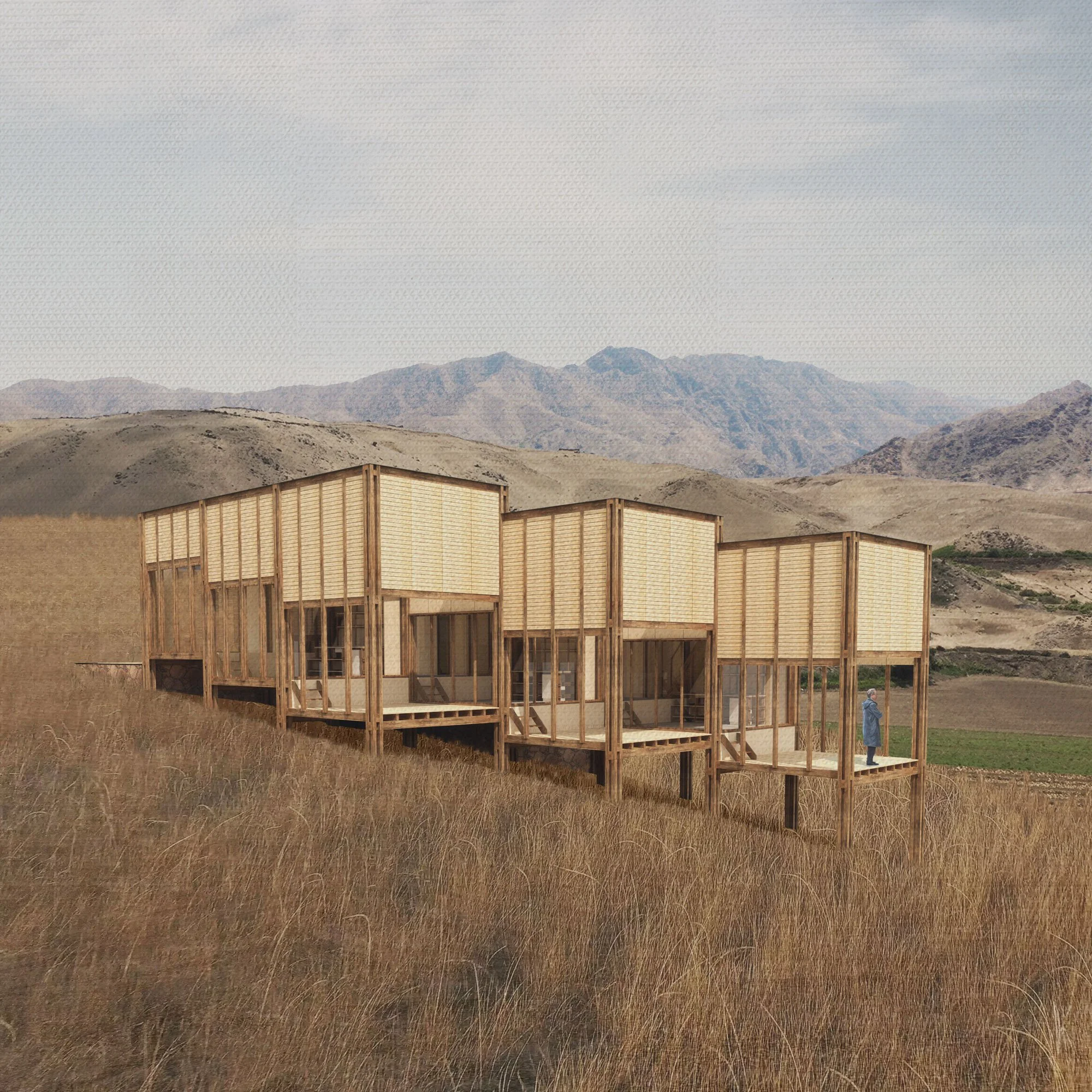
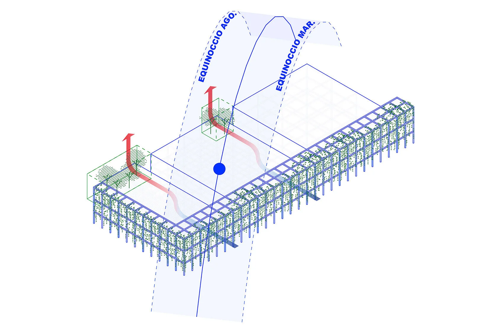
The four walls on the site supposedly served to "filter" the arrival of the pilgrims and thus define waiting areas, from the least sacred to the most sacred. The project seeks to reveal the memory of this area and recover this space-time condition. own thanks to the installation of 8m high poles that recover the footprint of the walls at the territorial level. The location and density of vegetation and programs also respects this "degradation" as the project approaches the monumental zone.
III-PLATFORMS
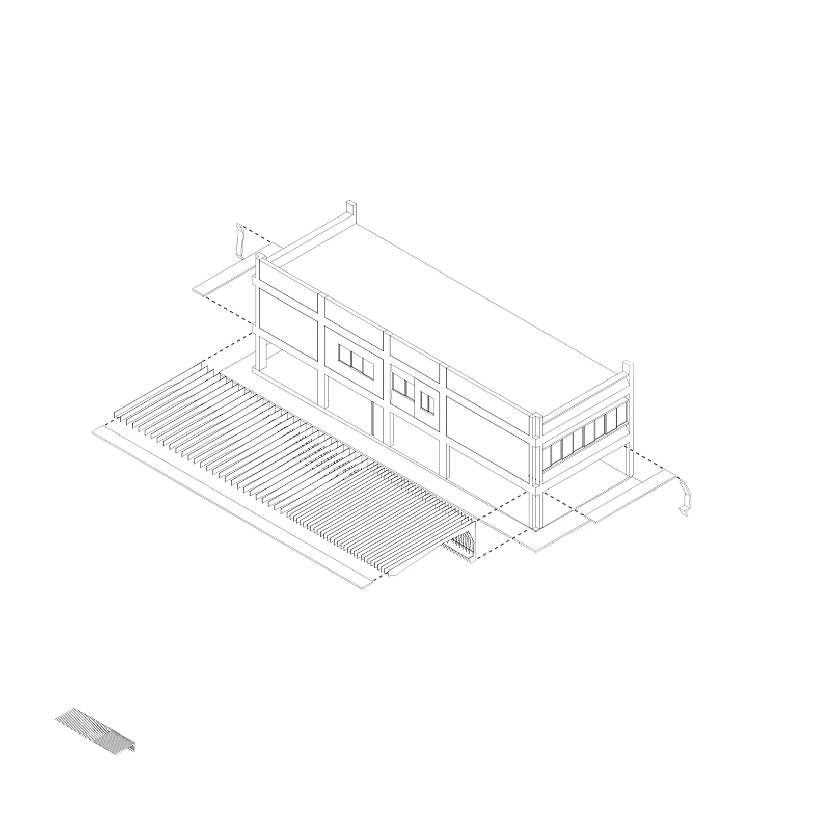
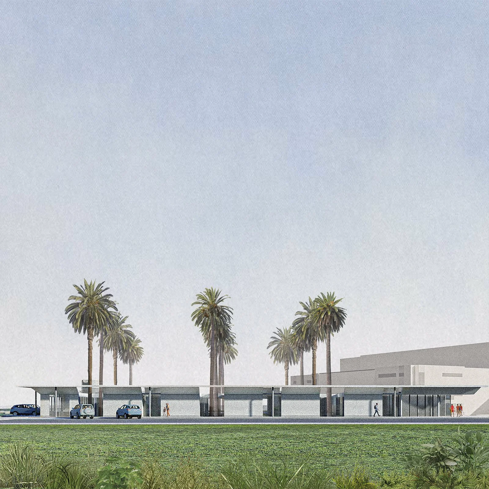
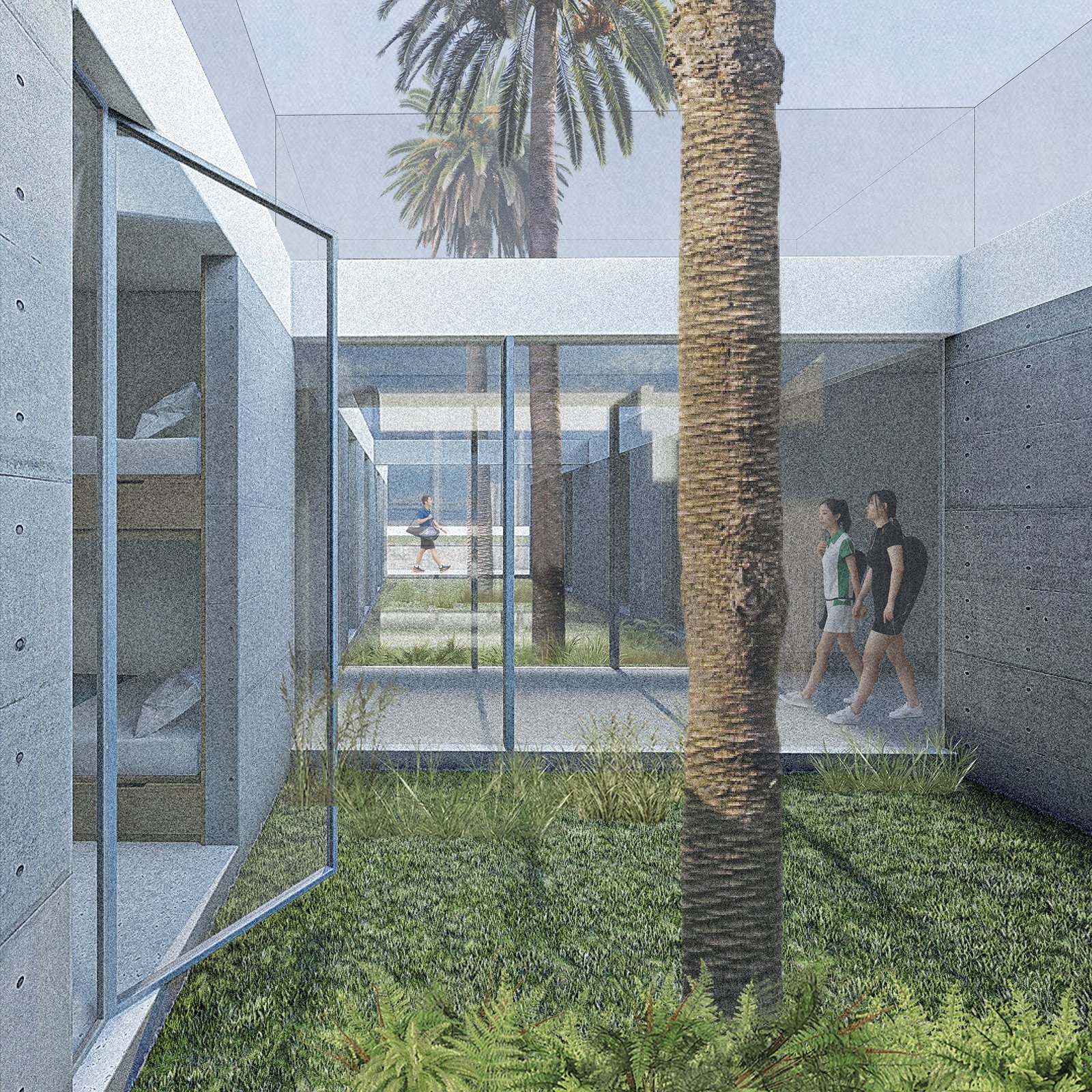
The Pilgrim’s Plaza, in the monumental zone, had a double function: it served as the last transition zone for the pilgrim, on the edge of the wall 1, between the internal route of the Sanctuary and the Painted Temple in the most sacred area from the site of Pachacamac. At the same time, it contained a covered area with shade that formed a large public space. The proposal appropriates the size and the monumental proportion (300x70m) of the Pilgrim’s Plaza and at the same time reinterprets its social and use dimension to define new urban pieces in the park's project. These platforms operate as "staples" between the fabric, the park and the desert pampas. These are points of activity that concentrate all the programs of the park and host large public spaces. Its location and orientation with respect to the edge are determined by the existing voids and current flows in the fabric. Distanced from each other of more or less 500m, the platforms rhythm the pedestrian path of the park and articulate the project with its surroundings. The 8 staples assume a metropolitan scale to operate as a transition scale between a very neighborhood fabric and a very large desert pampa. The materiality of it ground varies depending on the program it host and the relationship it establishes with the desert texture.
IV-INTEGRATIVE ROUTE
The design of the Park uses an internal route as a structuring and integrating component. It is a pedestrian infrastructure with bike path that connects the 8 platforms of the project. Thanks to signposts and information points, the road has a didactic function to understand the modern and pre-Hispanic heritage and the environmental importance of the Lurín valley. The road zigzags at the edge of the northern sector to link in strategic places the urban fabric, the park and the desert pampas. When connecting with the Pilgrim’s Plaza, it modifies the current tourist route within the monumental zone to recover the real scale of the Sanctuary (Sector North and Sector South). The path configures, between the platforms, zones of contemplation that complement the activated "staples". A path of contemplation punctuated by viewpoints and a shaded area that rhythms the route. Finally, the road proposes a new pilgrimage, not to the sacred place, but to an ecological infrastructure and didactic equipment.








![ISOMETRIA SISTEMA [].jpg](https://images.squarespace-cdn.com/content/v1/57e6b0d2d2b857a31e10b8cf/1584810933328-D4D12DDF10CVWDHQTZED/ISOMETRIA+SISTEMA+%5B%5D.jpg)
![ISOMETRIA SISTEMA ESTRUCTURA [].jpg](https://images.squarespace-cdn.com/content/v1/57e6b0d2d2b857a31e10b8cf/1584811086544-T5OB8VV22Q9WCJCXI2L5/ISOMETRIA+SISTEMA+ESTRUCTURA+%5B%5D.jpg)
![ISOMETRIA EXPLOTADA SISTEMA [].jpg](https://images.squarespace-cdn.com/content/v1/57e6b0d2d2b857a31e10b8cf/1584811146223-XR6FDEISLRJNUVX67TM1/ISOMETRIA+EXPLOTADA+SISTEMA+%5B%5D.jpg)


